Here is a some pictures of a recent camping trip to the Cairngorm National Park in Scotland. When I get around to working out to use google maps I will post a route.
Me and Marcus drove to The Linn of Dee, from there we biked it along a reasonably good land rover track at night to Bob Scott Bothy where we spent the night.
 |
| Bob Scott Bothy, very warm and snug. |
 |
| Scots Pine around the Bothy |
 |
| Its good to have a bike in these parts it saved alot of leg work |
 |
| Ben Macdui in the middle, and the ridge Sron Riach that we climbed up the next day. |


 |
| Devils Point (or Penis) was renamed to not offend Queen Victoria |
 |
| First Sight of Corrour Bothy |
 |
| Bridge to Corrour |
 |
| Corrour Bothy |
 |
| Devils Point |
 |
| Gaffa Tape is ideal for preventing blisters... |
 |
| Climbing up to Cairn Toul , Ben Macdui opposite across the Lairig Ghru. |

 |
| Looking back to The Devils Point. |
 |
| Carn a Mhaim Ridge on the left we traversed that way the next day from Ben Macdui. |
 |
| 1213m it had started to rain heavily in big soft snow flakes |
 |
| Looking up the Lairg Ghru, the high pass to Aviemore. |
 |
| Emergency Shelter, not recommended as an overnight stop...we had a brew here after coming down off Angels Peak. |
 |
| Lairig Ghru |
 |
| Lairig Ghru |
 |
| Nearly back at Corrour Bothy |
 |
| My MSR Hubba Hubba HP |
 |
| The next day and sun! |
 |
| Ben Macdui, the second highest in the UK |
 |
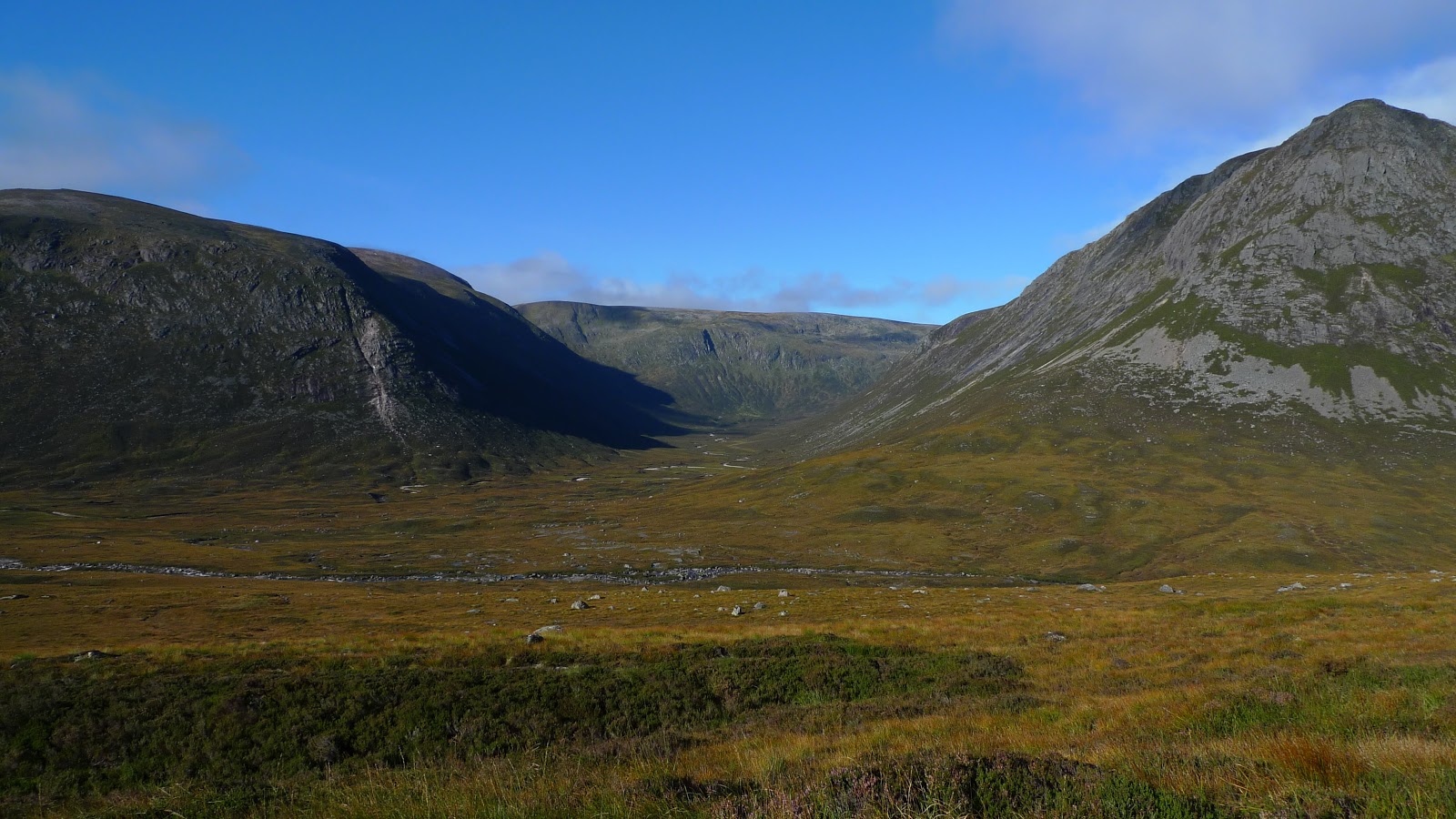
| Looking North up the Lairig Ghru |
 |
| We pitched the tent up in Glen Luibeg then went up Ben Macdui |
 |
| The long long path up Ben Macdui |


 |
| Looking across to Cairn Toul |


 |


 |
| Carn a Mhaim we walked along this ridge on the way back |
 |
| Lochan Uaine |
 |
| Add caption |


 |
| The summit of Ben Macdui |


 |
| 'Arse roc'k as we nick named it... |
 |
| Looking back to Ben Macdui and along the ridge |
 |
| Lairig Ghru and Corrour Bothy far below. |
 |
| Lairig Ghru. |

 |
| Looking towards Linn of Dee and the way we had cycled two days before. |

 |
| Back at the tent and time for a well earned brew. |
Beautiful pictures Tom x
ReplyDeleteThanks!x
Delete